
French, Spanish, and English Settlements to 1754 Map
This map comes from Maps101, our premier online social studies resource. Maps101 is a web-based interactive database of teacher lesson plans, geography tools, online learning games, dynamic interactive map modules and over 4,000 viewable and printable history, thematic, reference, outline, current event, and animated maps.
This map comes from Maps101, our premier online social studies resource. Maps101 is a web-based interactive database of teacher lesson plans, geography tools, online learning games, dynamic interactive map modules and over 4,000 viewable and printable history, thematic, reference, outline, current event, and animated maps.
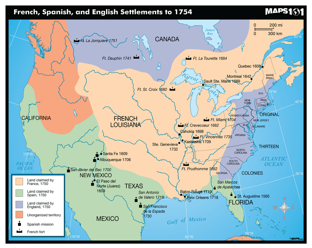
Visit Maps101 to show students the world in a new way. This Early Settlements Map clearly illustrated and color coded showing the French, Spanish, and English Settlements to 1754. This United States map highlights the areas inhabited by the European occupiers from France, Spain and England in 1750.
Customer Reviews
0.0 Be the first to review this item
Write a Review Filter Reviews: