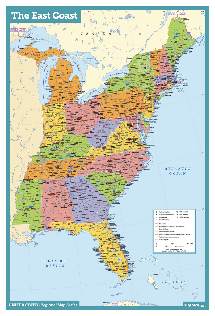

The MAD MAP's East Coast Wall Map is a very complete, detailed map of the East Coast United States. Using vibrant colors combined with an abundance of information this map is suitable for use in business or reference.
Coverage Area: Michigan, Indiana, Kentucky, Tennessee, Mississippi, Alabama, Ohio, Maine, New Hampshire, Vermont, Massachusetts, Rhode Island, Connecticut, New York, Pennsylvania, New Jersey, Delaware, Maryland, West Virginia, Virginia, North Carolina, South Carolina, Georgia, and Florida.
Detail on this map includes:
- State Capitals
- Primary Cities
- Secondary Cities*
- Some Towns*
- US Interstates (numbered)
- US Highways (numbered)
- Major Freeways, Highways, and Toll Roads
- Major Lakes & Rivers
- Time Zones
- Longitude/Latitude Graticule
*Minimum population of 5,000. Most towns are displayed in less populated areas such as the Dakotas. In densely populated areas like Chicago, NY, and LA, only those cities with population amounts greater than 50,000 are displayed due to space limitations.
The Paper version is printed on high quality semi-gloss paper, perfect for framing.
The Laminated version uses 3mm laminate on both sides for durability, is easy to clean and markable.
These maps are Printed on Demand.
Sizes are approximate and may vary due to the nature of the trimming and laminating processes.
More about the East Coast USA Wall Map
The east coast of the USA is a densely populated region. While a technical definition of east coast would only include those whose borders touch the Atlantic ocean (AKA, the eastern seaboard), this expansive east coast wall map is different. It ties the original 13 colonies in with the other early states, many of which were instrumental in the beginning of the industrial revolution. Indeed, the east coast of the USA is still the most industrialized region of the country today.
This map includes:- Coverage from Indiana to Mississippi on the western border
- Distinct state borders and colorful demarcations
- Secondary cities and towns in less populated states
- Primary cities and secondary cities in populated states
- States Capitals
- US Interstates and Highways by number
- Many Lakes and Rivers
- Longitude/Latitude demarcations
A wall map of the east coast of the USA is suitable for many uses, including business conference rooms or school reference libraries. Your east coast USA wall map can be printed on high-quality bond paper and laminated with 3mm laminate. Students and others can use dry erase pens to label and make connections between states and cleanup with a paper towel or dry erase marker is super easy. Also available as sticky maps for quick placement on classroom doors, walls, and more.
The MAD Maps East Coast Wall Map is a very complete, detailed map of the East Coast United States. Using vibrant colors combined with an abundance of information this map is suitable for use in business or reference.