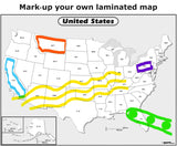
More on the Black and White US Outline Wall Map
Sometimes you don’t need a full-color USA map for your purposes. For example, perhaps you’re giving a sales presentation where you need to attach color diagrams onto various US states. You might want the map background to be informative but not ‘steal the show’ as some color maps might. You want your audience to focus on the sales data you’ve added, and to refer to the map for an idea of location.
Perhaps you’d like a wall map to display electoral results during a presidential election. Red and blue stickers can give you a real-time, visual display of whether the Republicans or the Democrats are winning, state by state.
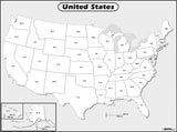
Maps.com’s Black and White US Outline Wall Map might be perfect for your needs. State boundaries are clearly defined, with thick black lines. All 50 states are labeled in a strong, black font using State abbreviations, eg, CO for Colorado.
Coastlines are attractively set in relief with a dark gray 3D effect. The ‘sea background’ is a light gray. Alaska and Hawaii are both depicted in insets at the bottom left corner of the map. There’s also a handy scale bar located near the bottom of the map showing distances in both kilometers and miles.


